At last! This is where the Pennine Way stops being a bloody miserable plod through bogs and moors and turns into a much more enjoyable walk. I'm glad; I was getting close to thinking it was nothing but a walk for masochistic idiots.
There are three main attractions on the walk from Malham to Horton-in-Ribblesdale, namely Malham Cove, Malham Tarn and Pen-y-Ghent. The first is a semicircular 80m-high limestone cliff that was once home to a monstrous waterfall but which is now a dry and attractive interlude just north of Malham; the second is a large lake – a rarity in porous limestone country – that boasts a stately home on its shores; and the third is a huge limestone hill that towers over Horton-in-Ribblesdale and gives great views of the Yorkshire Dales National Park. Even the most cynical walker has to enjoy a day like today, especially when that cynical walker is planning to meet his girlfriend at the end of the walk for a romantic weekend in the dales.
The day started off with a big breakfast in the pub at Kirkby Malham, an event that was considerably enlivened by me catching one of the staff unawares behind the bar as she poured herself a very large Bacardi. All I wanted was to pay my bill, but instead I got the memorable sight of a middle-aged woman wrapped up in her dressing gown, guiltily twirling round from the Bacardi optic as I asked if I could settle my account. Mumbling that the landlord would be back soon and that he dealt with the bills, she shoved the glass under the counter, sloshing the sizeable measure of spirits up the sides and totally failing to hide the fact that she was hitting the sauce at 8am.
I didn't join her.
On the Trail

On the way from Kirkby Malham to Malham I ended up hacking round a field for ages, trying to work out where the trail had gone cold. I couldn't understand it; there was Malham, just a few hundred metres away, but could I find the path? Could I hell, and I spent a good half an hour trying to work out where I was supposed to go before I gave up, jumped a couple of locked gates and came into town from the opposite direction. I wondered whether I'd accidentally been given the staff breakfast instead of mine, but Malham Cove soon blew the cobwebs from my head.
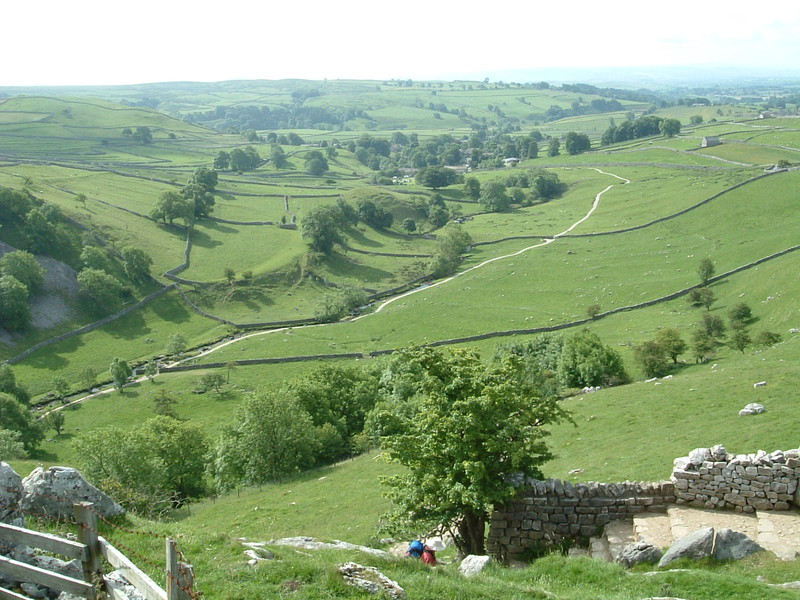
Limestone country often produces interesting rock formations and Malham Cove is a good example. You could be forgiven for thinking that it's all that remains of an ancient quarry that's been overrun with pretty greenery and a gently flowing river, but actually it's totally natural and is all the more beautiful for it. It looks as if a huge spoon has taken a scoop out of the side of a hill, leaving a curved white cliff that you can walk into and admire from the dizzying depths of the cove's floor, through which Malham Beck gently flows on its way south to Malham.

Even stranger than the cove are the limestone pavements at the top of what would have once been the waterfall (these days Malham Beck flows through the limestone and simply appears at the bottom of the cove, avoiding all that inconvenient leaping over the edge). These pavements contain long grooves that provide a sheltered home for collections of tiny plants, and after the long climb up the west side of the cove they're quite a sight.
A better sight would have been the odd signpost indicating where the Pennine Way went, but I'm rapidly discovering that the Pennine Way is one of the worst marked tracks in the country. I've walked along countless local and national routes on this trip, and even the littlest local ways have been liberally sprinkled with way-markers; sure, the Limestone Link back in Somerset gave me a few problems but it got better pretty quickly, and the Limestone Way in Derbyshire was appallingly marked, but both of these were still better than the Pennine Way.

It's strange, but the only markers on the Pennine Way seem to be ancient wooden signposts that are cleverly designed to be the same colour as the countryside. This prevents unsightly scars on the landscape but it also means the signs blend perfectly into the background, making them invisible until you stub your toes on them. Meanwhile signs are conspicuously absent from a number of key places and it's incredibly easy to get lost. I've now ditched the route guides I've been lugging around and I'm just using my maps and compass; this doesn't help me stick to the Pennine Way but it does enable me to pick my own route along what may or may not be the Way. This seems to be the best approach, especially as the Way is constantly shifting around to minimise damage to the environment from the action of thousands of walkers' boots. You'd think good signposts would be a sensible way to stop walkers from straying off the route and into sensitive areas, but it just doesn't seem to work like that round here.
Malham Tarn

I finally reached Malham Tarn after a happy combination of ignoring the little green line on the map and following my compass. It's very unusual to find lakes in limestone country as limestone is porous and can't hold water, but Malham Tarn is above an ancient layer of impervious rock so it sits on top of the local limestone like a saucer of water sitting on a sponge.
It's a lot more beautiful than that rather unglamorous analogy would suggest. As you approach the tarn from the south it opens up in front of you to reveal the kind of setting that you'd pay good money to have in your back garden. This is no coincidence because this whole area is the product of the late 18th century, when Lord Ribblesdale expanded the tarn with some judicious dams and built a hunting lodge on the northern shore of his newly expanded lake. Of course, this hunting lodge is hardly a wooden shack; instead it's a grand country house that looks over the tarn from the middle of a dark green wood, with open lawns that roll down from the large windows in a way that screams 'old money.' These days the lodge is a field study centre run by the National Trust, and even though the Pennine Way goes round the eastern shore of the tarn and right past the lodge itself, there are signs everywhere making it pretty plain that members of the public are not allowed to explore the grounds. I didn't hang around; if you're not welcome, you're not welcome, and there's always something more interesting round the next corner.

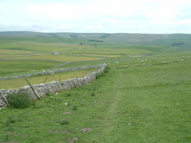
It took a while to get there, though. Before reaching Pen-y-Ghent the Way makes a long, slow climb over Fountains Fell, a nondescript area of shake holes, old mine workings and hidden shafts where you're instructed to stay on the path to avoid a painful death. The ascent was made considerably harder by the weather, which I couldn't work out at all. When the clouds let it shine the sun was scorching, beaming down the kind of searing heat that burns your skin before you've even had a chance to feel the warmth; but coupled with this summer sun was the coldest wind I've felt in a long time. As I climbed up Fountains Fell the wind got stronger and gustier and halfway up I had to stop to put on my woolly hat and my Gore-Tex jacket, just like at the start of yesterday's walk. And so the climb turned into a continuous switch from exposed parts of the path, where the cold westerly wind rattled the teeth in my head and made my eardrums ache, to sheltered dips where the sun beat down and drenched my T-shirt with sweat. It wasn't pleasant, but then I reached the top and understood what the fuss was all about, for there was Pen-y-Ghent.
Into Horton

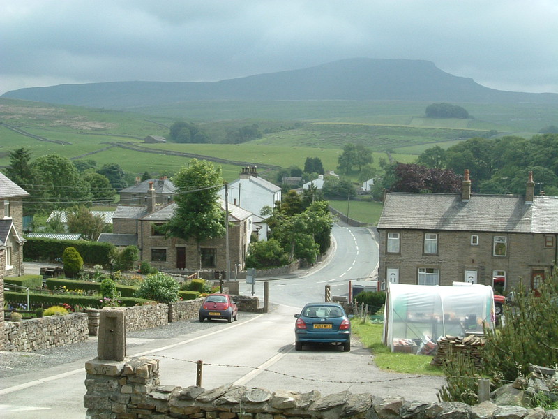
This area of the world is famous for its three peaks. Pen-y-Ghent, Ingleborough and Whernside dominate the landscape, their distinctive humpback shapes being the result of weathering on their limestone and sandstone layers. Every year there's a charity event where people 'do the Three Peaks', a 26-mile walk that takes in each of the three summits. The Pennine Way isn't quite that insane but it does go right over the top of Pen-y-Ghent, the nearest peak to Horton-in-Ribblesdale.
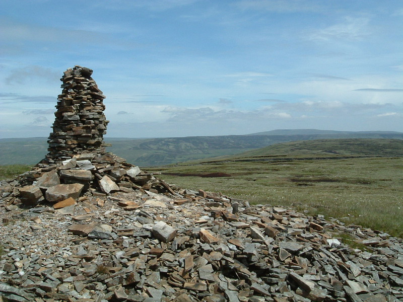
From the top of Fountains Fell there's still a considerable walk to the base of Pen-y-Ghent, but the view is constantly engaging as you head towards the beached whale ahead of you. The ascent looks impossibly steep, but on a clear day it's easy to pick out the little coloured flashes of other climbers as they scramble up the 200m climb to the top. At times it's more like rock climbing than walking, especially when the path crosses the limestone shelf that juts out halfway up the ascent, but it's worth it for the views from the 694m summit. Broad valleys lie on either side, one scored by the Pennine Way that you've just walked along and the other home to Horton-in-Ribblesdale, the small village that lies at the foot of Horton Quarry. This is without a doubt the most impressive landscape I've yet walked through; the peak of Pen-y-Ghent is the highest I've been so far, but even without that distinction this area would win hands down. Southwest England is for the most part flat, but up here it most definitely isn't and it makes for good hiking.

But it's tiring, scaling these peaks, and from the top of Pen-y-Ghent I could practically smell the pub. Peta had booked us a room in the Golden Lion Hotel in Horton, and as I scrunched my way down the rocky path towards my reward of hot bath and cold ale, my brain played its usual trick on me. Every time I walk into a new place where I've booked a bed, my brain taunts me with the thought that something might have gone wrong with the booking. Perhaps I got the wrong date when I booked? Or the wrong hotel? And I'll walk in and say, 'I've got a reservation,' and they'll look at the book, suck air through their teeth and say, 'I'm sorry, but you haven't, and I'm afraid we don't have any vacancies and nor does anyone else in town. Sorry.'
Of course, it never happens; I'm always in the book and five minutes later I'm in my room, listening to the steamy sound of the bath filling up and dreaming of how many steaks I'm going to eat tonight. I was a little surprised, then, when the landlady behind the counter at the Golden Lion said, 'I can't find you in the book, and we're totally full.'

'Are you sure?' I asked, rather stumped.
'She's right,' said a guy next to me at the bar. 'I've block-booked the whole place and there are no rooms left – it's the Three Peaks race today and the whole town is full up.'
'Um,' I said. 'Ah. Shit.'
'You'll probably find somewhere in Settle,' said another guy at the bar. 'It's only five miles away.'
'Yeah, but my girlfriend's on the way up from London, and she's going to be arriving at Horton station at seven,' I said.
'No problem,' he said. 'Settle's the stop before Horton, so she could get off there. I'll give you a lift if you like; I'm going there in 15 minutes.'

So things suddenly turned around due to the kindness of strangers. My phone didn't have a signal in Horton but the guy with the car offered me his phone to ring Peta and reschedule, and his friend even rang the Golden Lion in Settle so I could find out whether she had accidentally booked there instead; she hadn't, but they had one double room left so I reserved it on the spot and gratefully took the man up on his offer of a lift.
Settle turned out to be a good move. Bigger than Horton by a long way, it provided Peta and I not only with a lovely room in a good hotel, but it also gave us scope for eating and drinking in a way that Horton couldn't match. So we settled down for a rest day that would involve wandering along the river, sitting under trees and absolutely no peaks. What a pleasant change...